|
Landscape records of past ice sheets
During the Last Glacial Maximum (LGM, globally around 20,000 years ago), the a larger proportion of the high latitudes were covered by ice sheets, leaving behind footprints (glacial landforms) and archives (sediments) of ice advance and retreat across landscapes. We use sediments and landforms to better understand ice sheet behavior and processes and conditions that impact ice flow and retreat. |
|
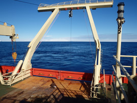
Recovering a sediment core from the RVIB Nathaniel B Palmer in the Ross Sea onboard cruise NBP1502.
|
In the Ross Sea of Antarctica, we find variable styles of retreat were influenced by regional topography and seafloor geology (Halberstadt et al., 2016, The Cryosphere; Simkins et al., 2016, GSL Memoirs). Coupled sediment facies analyses and geomorphology reveal clear distinctions between subglacial and ice-proximal facies, proximity to paleo-grounding lines based on the presence of ice shelf basal debris in sediment cores, and changing marine influence (Prothro et al., 2017, Marine Geo; Prothro et al., 2020). The East Antarctic Ice Sheet re-advanced during a massive ice sheet reconfiguration (Greenwood et al., 2018), and an abrupt increase in atmospherically produced beryllium-10 and diatom concentrations at the facies transition to open marine conditions supports an ice shelf collapse event in the late Holocene (Yokoyama et al., 2016, PNAS).
Simkins et al., 2018, TC. An assessment of 6,275 glacial landforms deposited at paleo-grounding lines, reveal two endmember modes of grounding line retreat: (1) an irregular mode, characterized by grounding zone wedges, and (2) a steady mode, characterized by moraine sequences . We suggest that while sediment accumulation and progradation may prolong the stability of a grounding line position, progressive development of sinuosity in the grounding line due to spatially variable sediment delivery likely destabilizes the grounding position by enhanced ablation, triggering large-magnitude retreat events.
Simkins et al., 2018, TC. An assessment of 6,275 glacial landforms deposited at paleo-grounding lines, reveal two endmember modes of grounding line retreat: (1) an irregular mode, characterized by grounding zone wedges, and (2) a steady mode, characterized by moraine sequences . We suggest that while sediment accumulation and progradation may prolong the stability of a grounding line position, progressive development of sinuosity in the grounding line due to spatially variable sediment delivery likely destabilizes the grounding position by enhanced ablation, triggering large-magnitude retreat events.
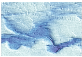
Meander in paleo-subglacial channel, cut into sediments with undulating thalwegs, on the Antarctic continental shelf.
|
Subglacial hydrology
Geological observations offer unique perspectives on the nature and influence of subglacial hydrological systems on broad spatiotemporal scales. Our work on paleo-subglacial meltwater landforms and subglacial hydrology are featured in the following peer-reviewed articles. Simkins et al., 2017, Nature Geoscience. Episodic channelized meltwater drainage locally restricted grounding line landform growth, limiting the degree to which landforms could have provided stability feedbacks to the grounding line. Meltwater drainage configuration persisted through numerous grounding line retreat events, shifts in ice flow direction, and a circuitous retreat pattern, suggesting that the stable location of source lakes and ample production of basal melting influenced the retreating ice stream. Simkins et al., 2021, Geophysical Research Letters. A relict subglacial meltwater network preserved on the Antarctic seafloor formed a persistent pathway for water drainage when the East Antarctic Ice Sheet was much larger. The landforms within the drainage network implicate substantial changes in how subglacial water drainage was influenced by the shape of the underlying terrain and demonstrate the prolonged impacts that meltwater corridors have on the retreat of glacial ice. |
|
Merging evidence of paleo- and modern grounding lines
Currently Antarctic Ice Sheet ice mass loss largely occurs at the margin, which for our purposes encompasses ice shelves (if present) and grounding lines (the downstream termination of ice in contact with the bed below). These environments are influenced by a host of marine, geological, and glaciological influences that converge an interact to produce variable ice behavior across the ice sheet and even between neighboring ice systems. Ongoing work focuses on the development and influence of grounding line sinuosity on ice sheet behavior using hundreds of grounding line landforms on the deglaciated Antarctic continental shelf, marking post-LGM retreat of the Antarctic Ice Sheet, with contemporary grounding line geometries. Through NSF-OPP Grant 1745055, we are exploring how grounding lines respond to variable environmental forcings and subglacial topography and roughness. |
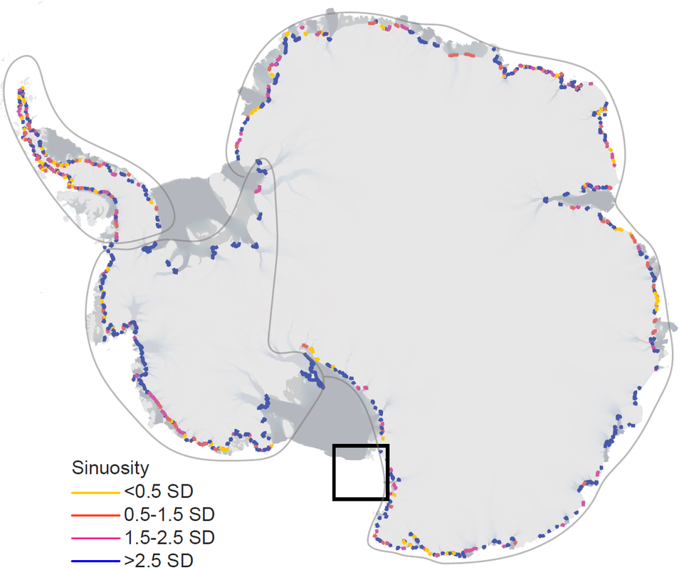
Circum-Antarctic grounding line sinuosity.
|
|
Pre-satellite era changes of Thwaites Glacier, West Antarctica
While modern remote sensing methods (e.g., Ice-Sat, Cryo-Sat) reveal recent and ongoing changes in ice flow velocity, ice shelf extent, and calving events, we look to the geologic record to identify past changes in glacial behavior spanning hundreds to thousands of years. Under the THwaites Offshore Research (THOR; NSF PLR 1738942) initiative of the International Thwaites Glacier Collaboration (ITGC), we work with collaborators from the US and the UK to investigate one of West Antarctica’s most unstable systems. Our ongoing work within the THOR objectives focuses on identifying and characterizing sediment deposits mobilized by meltwater plumes. We combine sedimentological and geochemical methods to identify and characterize meltwater deposits by distributions of grain sizes and concentrations of trace metals. By constraining the timing and frequency of the Thwaites meltwater discharge history, and integrating that history with pre-satellite glacial retreat, we can better understand the impacts subglacial meltwater has on Thwaites’ stability. Additionally, we consider stable isotope chemistry of pore water recovered from these sediment cores as a way to differentiate between water sources. |
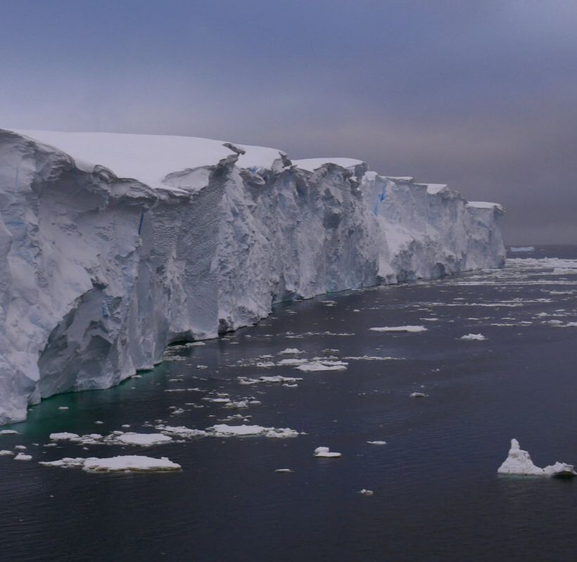
Thwaites Glacier calving line (photo credit: R. Larter)
|
|
Glaciated landscapes & sea levels at the margins of the Cordilleran and Laurentide ice sheets
Parts of North America were covered in several kilometers of ice during the Last Glacial Maximum (LGM). While the Laurentide Ice Sheet (LIS) reached its maximum over the central and eastern United States with the global peak around 20,000 years ago, the Cordilleran Ice Sheet (CIS) reached maximum ice volume over western North America as late as 14,500 years ago. We focus primarily in the Puget Lowland of Washington State (e.g., Simkins et al., 2017; Demet et al., 2018), a region that was below sea level during the LGM. The Puget Lobe of the CIS is not well constrained using modern technological and analytical approaches, but is of particular interest due to paleo-ice retreat across a rebounding solid Earth, which is marked as a transition from marine to terrestrial and glacial to non-glacial sedimentary deposits. Our ongoing objectives include using LiDAR data to characterize glacial landforms in the Puget Lowland, collect glacial sediments, marine sub-fossils, and overlying terrestrial ‘emergent’ sediments from coastal cliffs, recover lake cores to constrain the transitions from glacial to non-glacial and marine to terrestrial deposition, and date the retreat of the CIS and the emergence of the landscape across the Puget Lowland. Understanding the interactions between marine-terminating glacial systems and solid Earth rebound will provide information relevant to contemporary marine glacial system stability and potential contribution to sea level rise. Additionally, ongoing work using glacial landforms of the Laurentide Ice Sheet during the LGM along the US East Coast focuses on quantifying the variable morphology of ice-sheet marginal moraines in relation to underlying topography and geological substrate properties. |

Coastal cliff outcrop recording the transition from subglacial sediments to post-glacial marine and terrestrial sediments, capped by a thin soil layer.
|